Scientific Seminar on Aboveground Forest Carbon Density Estimation Using Remote Sensing, LiDAR & Geospatial Technologies in Sarawak

Posted on 05 Nov 2025
Source of News: NREB
Miri 4 Nov 2025 I attended the Scientific Seminar on Aboveground Forest Carbon Density Estimation Using Remote Sensing, LiDAR & Geospatial Technologies in Sarawak held today at Mercure Hotel, Miri. The seminar featured six (6) technical papers presented by experts from Universiti Teknologi Malaysia (UTM), Forest Research Institute Malaysia (FRIM), and the Forest Department Sarawak (FDS). NREB Sarawak attended by Gs. Joseph Uyo, Senior Environmental Control Officer.

The papers presented as follows:
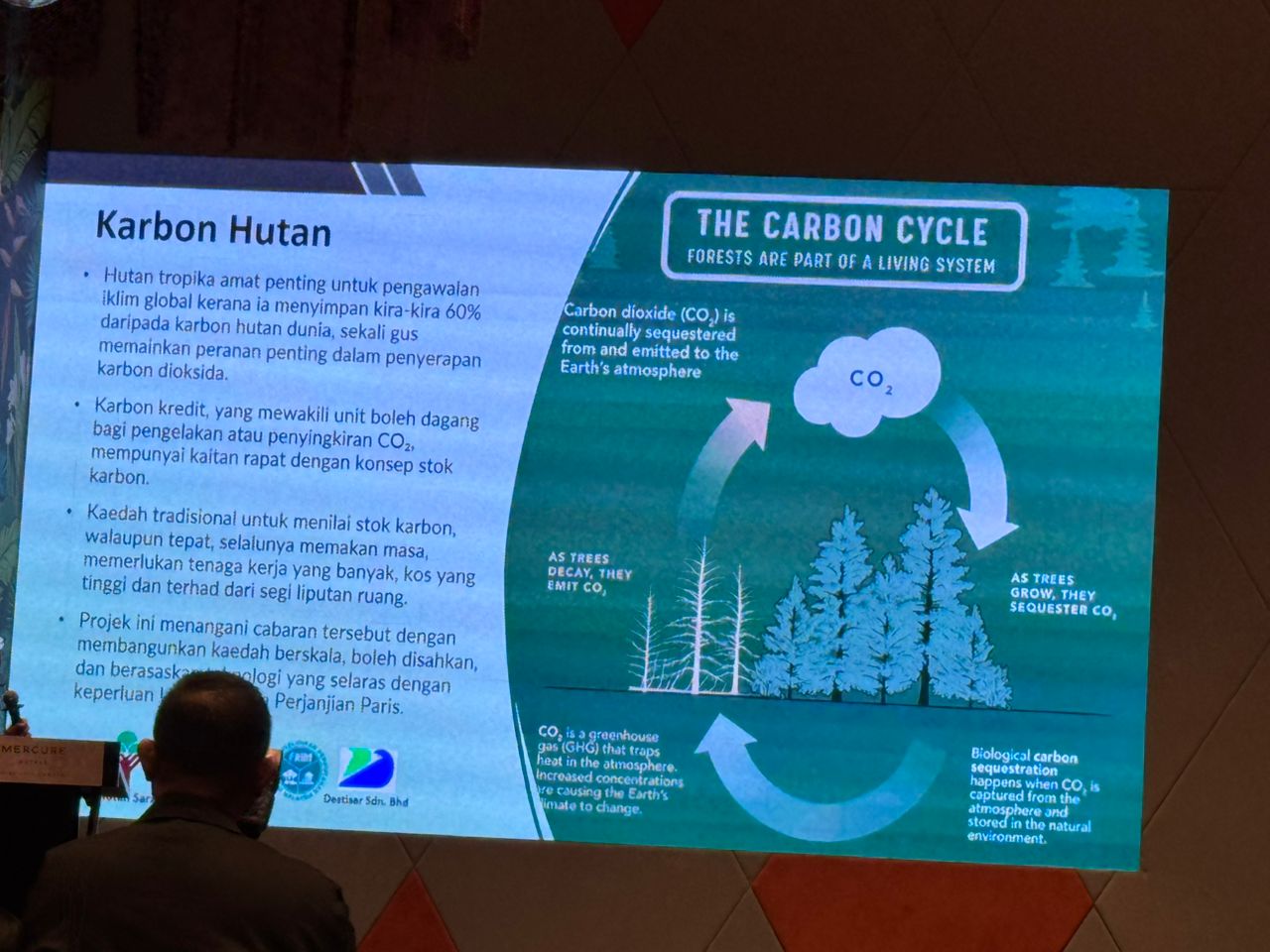
1. Aboveground Forest Carbon Density Estimation Using Remote Sensing in Sarawak
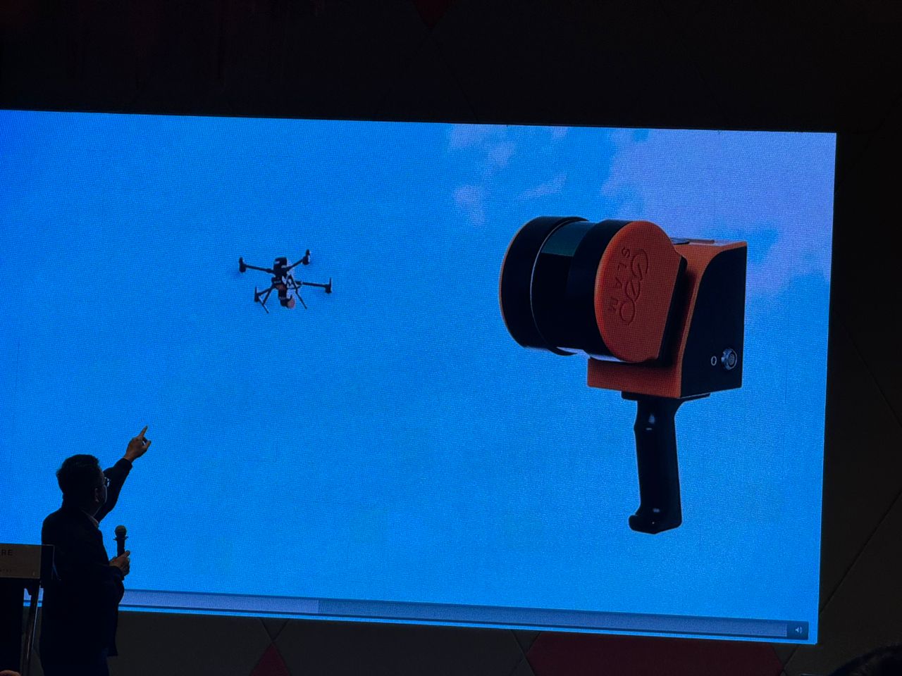
2. Advancing Forest Measurement and Carbon Estimation in Malaysia through Remote Sensing and LiDAR
3. Seminar Saintifik Pengiraan Stok Karbon Hutan Terpilih di Sarawak dengan Menggunakan Kaedah Penderiaan Jauh dan Teknologi LiDAR
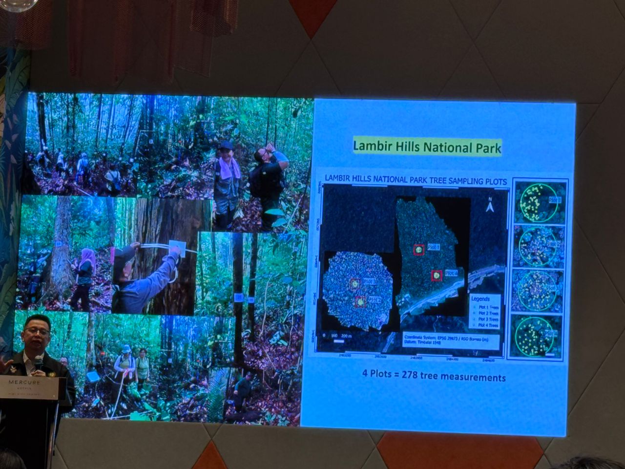
4. Efficient Plot-Level Tree Census for Aboveground Carbon Estimation Using Geospatial Approaches
5. Towards Accurate Aboveground Carbon Estimation in Malaysian Forests Using Geospatial Methods and Widely Recognised Allometric Models
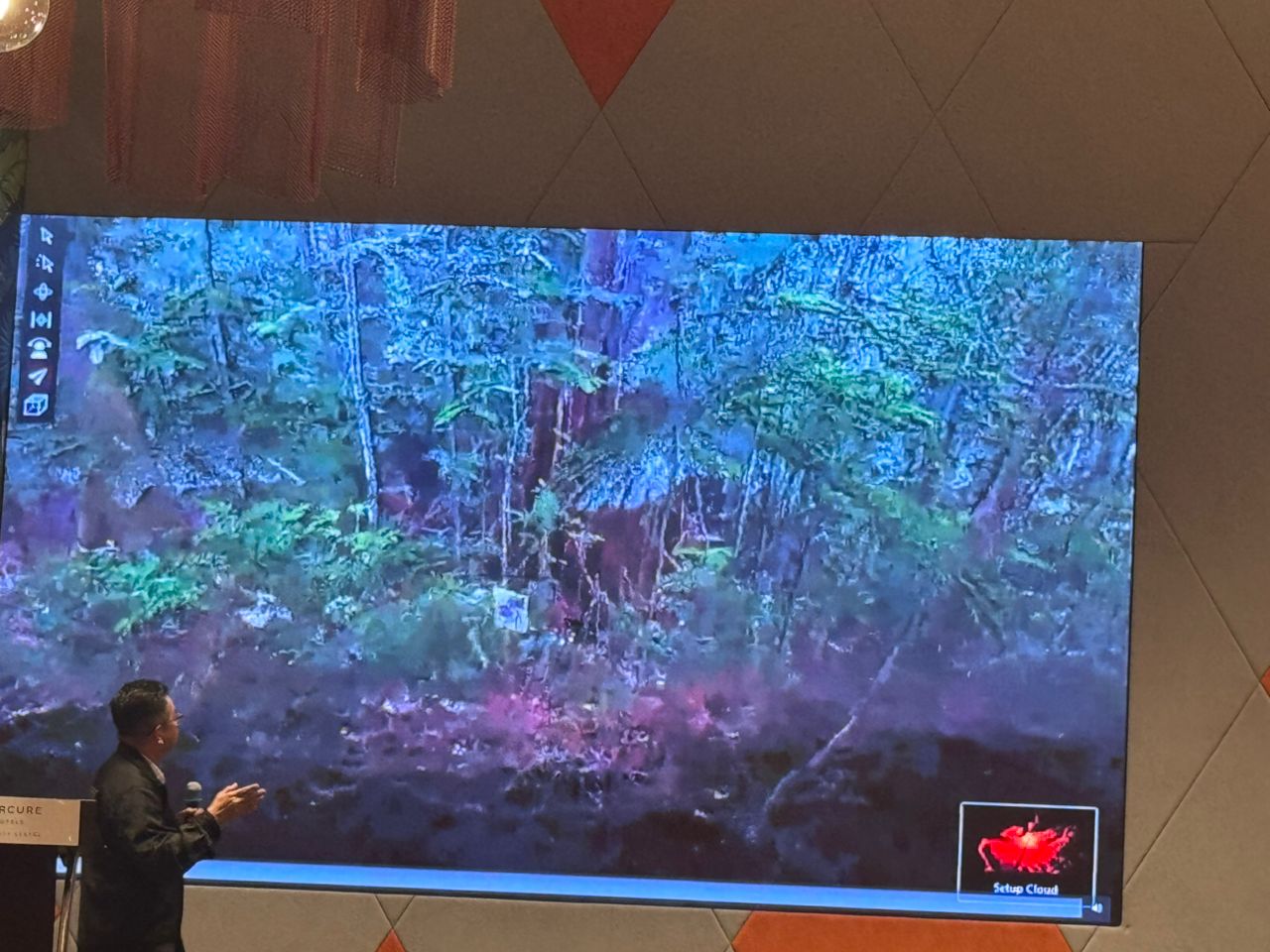
6. From Field Plots to Satellites: GeoAI-Enhanced Multi-Resolution Remote Sensing for Scalable Aboveground Carbon Estimation

The seminar provided valuable insights into current methodologies, technologies, and research advancements for improving accuracy in forest carbon density estimation, highlighting the integration of LiDAR, remote sensing, and geospatial approaches in the context of Sarawak’s forest ecosystems.

Report by Gs. Joseph Uyo

Scientific Seminar on Aboveground Forest Carbon Density Estimation Using Remote Sensing, LiDAR & Geospatial Technologies in SarawakScientific Seminar on Aboveground Forest Carbon Density Estimation Using Remote Sensing, LiDAR & Geospatial Technologies in SarawakScientific Seminar on Aboveground Forest Carbon Density Estimation Using Remote Sensing, LiDAR & Geospatial Technologies in SarawakScientific Seminar on Aboveground Forest Carbon Density Estimation Using Remote Sensing, LiDAR & Geospatial Technologies in SarawakScientific Seminar on Aboveground Forest Carbon Density Estimation Using Remote Sensing, LiDAR & Geospatial Technologies in SarawakScientific Seminar on Aboveground Forest Carbon Density Estimation Using Remote Sensing, LiDAR & Geospatial Technologies in SarawakScientific Seminar on Aboveground Forest Carbon Density Estimation Using Remote Sensing, LiDAR & Geospatial Technologies in Sarawak


BACK


Best viewed with Firefox, Google Chrome in 1920 x 1080 screen resolution.
© Copyright of Natural Resources And Environment Board Sarawak
Last Updated On 27 Nov 2025

Operation Hours:
Monday - Thursday
8:00 am - 1:00 pm & 2:00 pm - 5:00 pm
Friday
8:00 am - 11:45 am & 2:30 pm - 5:00 pm

Payment Counter:
Monday - Thursday
8:30 am - 12:30 noon & 2:00 pm - 3:00 pm
Friday
8:30 am - 11:00 am & 2:30 pm - 3:00 pm

* Close on Saturday, Sunday and Public Holiday

iso eia
image Polls