by Lim How Pim, 30 Aug 2026, Sunday
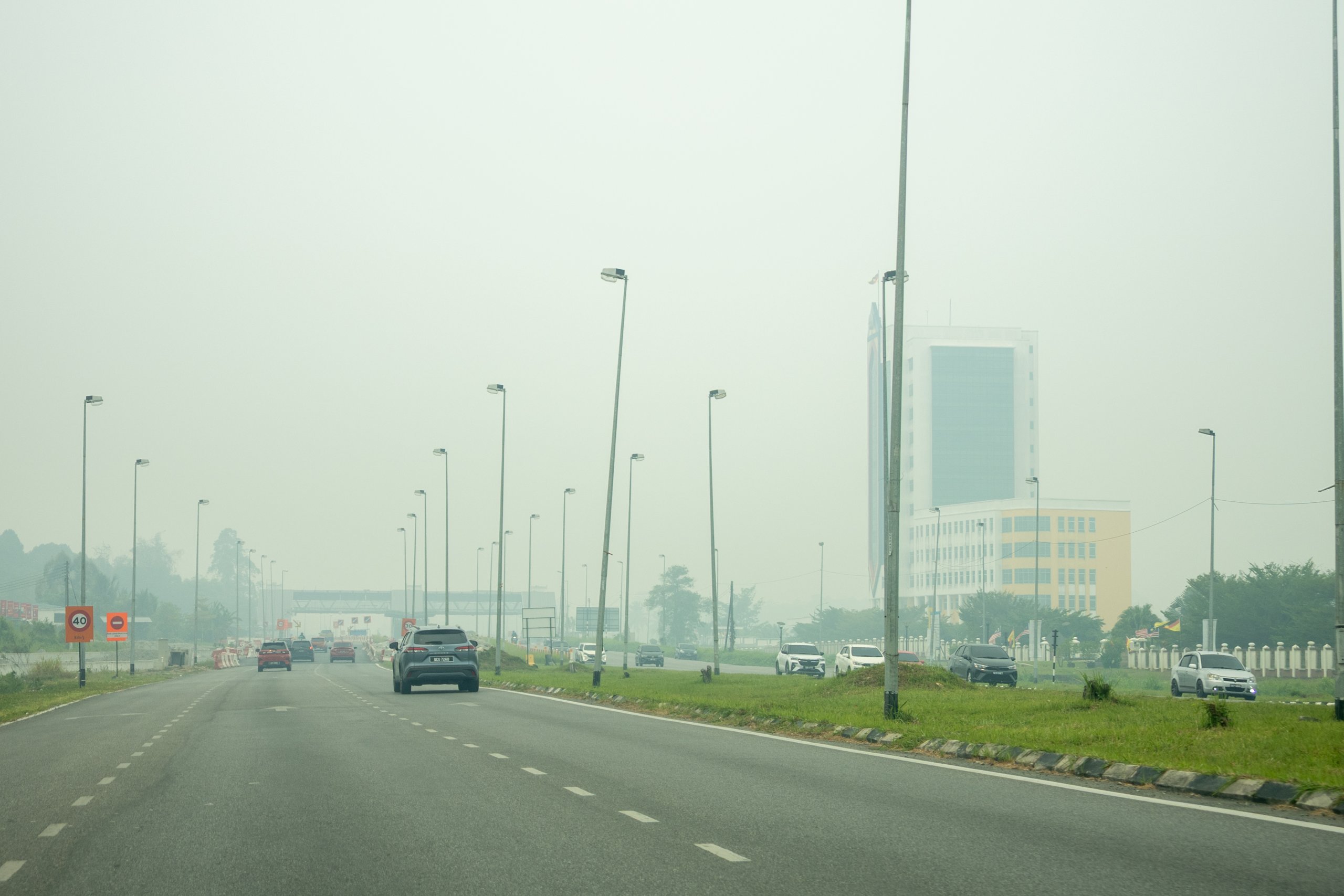
NREB says that with the El Niño conditions forecast to intensify in the coming months, hotspots and smoke haze conditions have the potential to worsen. – Photo by Roystein Emmor
KUCHING (Aug 30): Sarawak is likely to continue to experience haze in the coming days if the biomass burning increases outside the state’s borders.
According to the Natural Resources and Environment Board (NREB), the current southwest monsoon phase, which is expected to end next month, would have Malaysia receiving consistent winds from the southwest direction.
“This situation has the potential to cause possible transboundary haze and deterioration of ambient air quality in the Sarawak region,” it said in a statement on Sunday.
Citing the Asean Specialised Meteorological Centre (ASMC), NREB said a total of 185 hotspots had been detected in Sarawak from Aug 1 to 29.
During the same period, a total of 12,888 hotspots were detected in the neighbouring Kalimantan of Indonesia.
ASMC also reported that moderate to thick transboundary smoke plumes were observed in West Kalimantan and moving northwards into western Sarawak.
“Hotspot and haze conditions are expected to remain high in areas prone to fire and experiencing prolonged dry weather conditions, with a continued risk of severe transboundary haze.”
The ASMC activated Alert Level 3 for the south Asean region on Aug 26.
In recent days, the hotspot and haze conditions in the region have worsened due to the prolonged dry weather conditions.
Based on satellite monitoring, NREB said moderate to thick smoke haze was observed to be widespread from hotspots detected in Kalimantan, with moderate to thick transboundary haze observed to be moving northwards from the hotspots in West Kalimantan.
Dry weather conditions are forecast to continue in most areas of the south Asean region.
“With the El Niño conditions forecast to intensify in the coming months, hotspots and smoke haze conditions have the potential to worsen; thus, increasing the risk of severe transboundary haze events in the south Asean region, including our country,” NREB pointed out.
It advised the public, particularly the high-risk groups, to take precautionary measures during the current dry spell, including drinking plenty of water and reducing strenuous outdoor activities, as well as wearing face masks during outdoor activities.
By Sunday noon, Serian, Samarahan, Kuching and Tebedu recorded ‘Hazardous’ air quality with Air Pollutant Index (API) readings of 412, 332, 304 and 302, respectively.
Three areas with ‘Very Unhealthy’ API readings were Lubok Antu at 243, Lundu at 236, and Sri Aman at 228.
Ten locations that fell into the ‘Unhealthy’ category (API range of 101-200) were Sarikei, Sibu, Mukah, Kapit, Bintulu, Samalaju, Miri, Industrial Training Institute (ILP) Miri, Lawas and Bario.
Limbang’s air quality was at ‘Moderate’ level (API of 51 to 100).
The API reading is based on the Pollutant Standard Index (PSI) system developed by the United States Environmental Protection Agency (USEPA), which uses 24-hour average readings for five major pollutants: namely particulate matter with a diameter of less than 2.5 microns (PM2.5) and 10 microns (PM10); sulphur dioxide (SO₂); nitrogen dioxide (NO₂); ground-level ozone (O₃); and carbon monoxide (CO).
An API reading below 50 is considered ‘Good’; 51 to 100 is ‘Moderate’; 101 to 200 is ‘Unhealthy’; 201 to 300 is ‘Very Unhealthy’; 301 to 500 is ‘Hazardous’; and 501 and above, ‘Emergency’.
According to NREB, the health effects of PM2.5 depend on its concentration at any one time and the duration of exposure.
“This average also makes the API more stable and less affected by short-term changes.
“Therefore, hazy conditions do not necessarily immediately correspond to the API reading as air pollutants may take some time to accumulate, causing the API reading to rise,” it explained.
Meanwhile, platforms such as PurpleAir, which use low-cost optical particle sensors that estimate PM2.5 on a 10-minute average, can jump quickly when PM2.5 concentrations increase suddenly, and readings can also drop quickly when there are changes in meteorological conditions, such as wind direction and speed and rain that can help disperse or remove air pollutant particles.
“Therefore, if the PM2.5 concentration suddenly spikes in the last few hours, a platform like PurpleAir may continue to show very high readings, but the NREB and APIMS APIs will increase more gradually because their calculations still take into account previous periods of lower concentrations.
“In the context of Sarawak, the PM2.5 API is calculated based on 24-hour average values downloaded from the state-wide air quality monitoring network, namely five air quality monitoring stations (AQMS) operated by NREB in Lundu, Tebedu, Lubok Antu, Lawas and Bario; 12 continuous air quality monitoring stations (CAQMS) operated by the Department of Environment (DoE) in Kuching, Samarahan, Sri Aman, Sarikei, Sibu, Kapit, Mukah, Bintulu, Samalaju, Miri, ILP Miri and Limbang; and one mobile continuous air quality monitoring stations (MCAQMS) in Serian, also operated by DoE.
“All these stations are equipped with reference-grade regulatory air quality monitoring instruments, with quality assurance/quality control procedures, measurement, maintenance and data validation that have been set based on USEPA standards,” said the NREB.
Adding on, the NREB warned the public not to engage in open-burning activities that could cause air pollution, especially during the current dry season.
“Those caught carrying out open-burning can be charged under Section 30(1)(a) and Section 30(2) of the Natural Resources and Environment Ordinance (Cap. 84 – Laws of Sarawak, Ed. 1958).
“Convicted offenders will be fined not exceeding RM100,000 or imprisoned for five years, or both.”
The board also called upon the public to help extinguish small fires and report any open-burning to the nearest NREB office, or call NREB hotlines 082-447 488 or 082-319 500.


